Red Rock Country Landscape Transformation
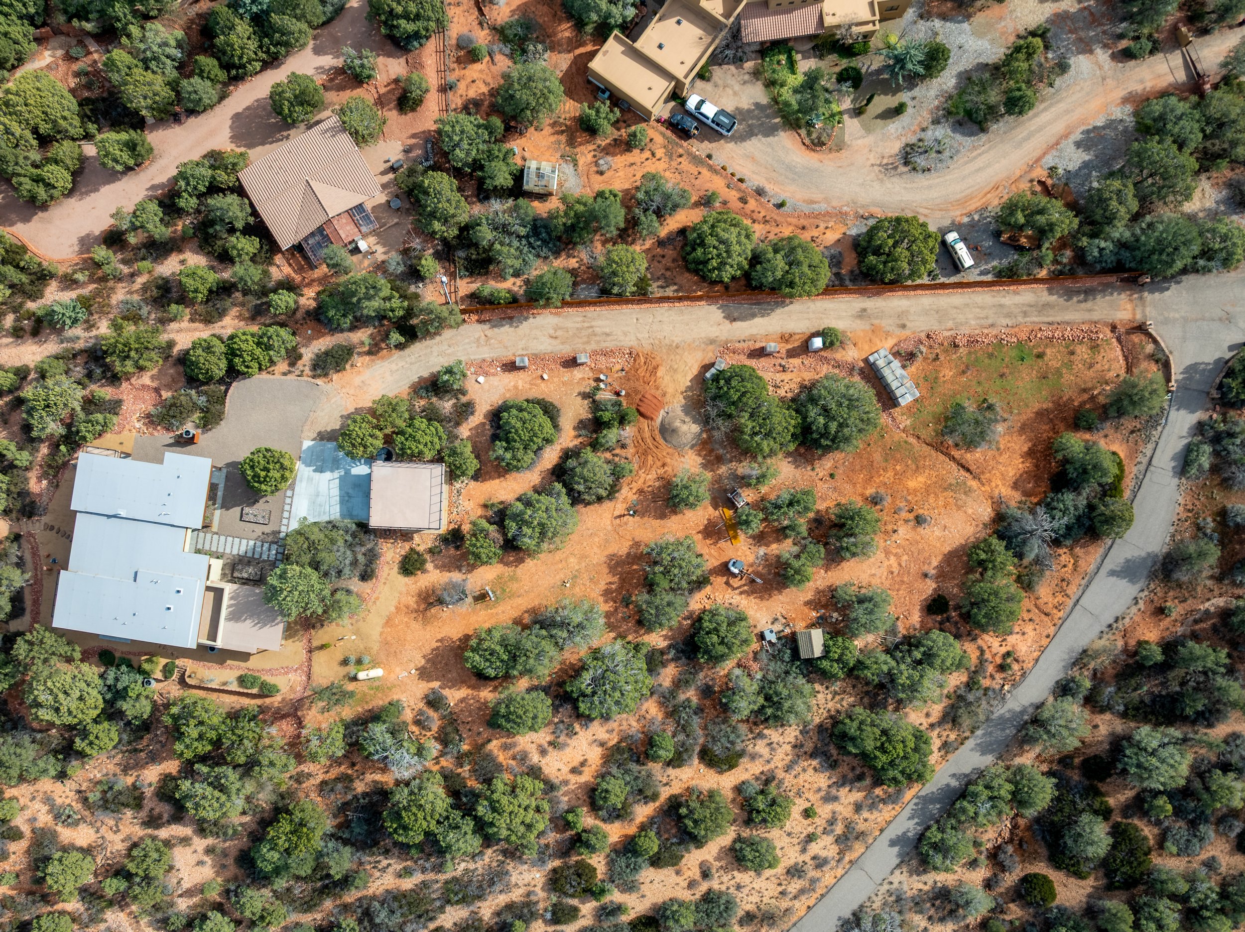
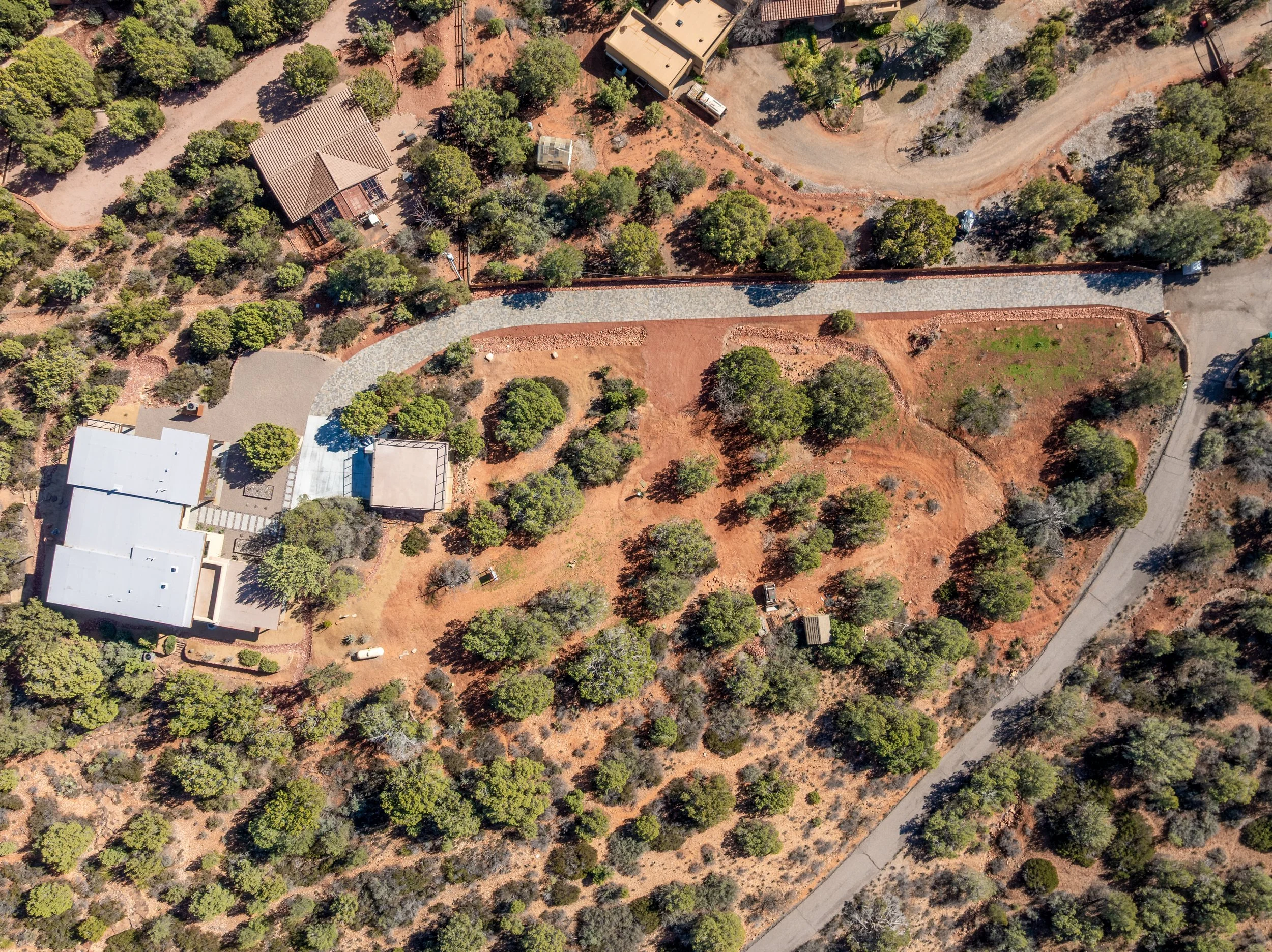
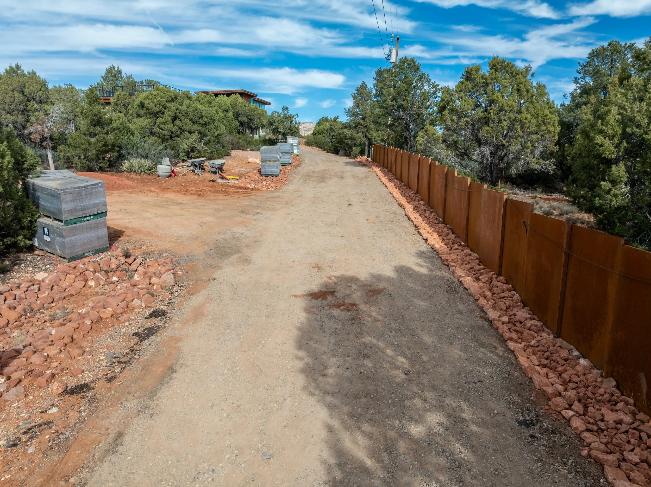
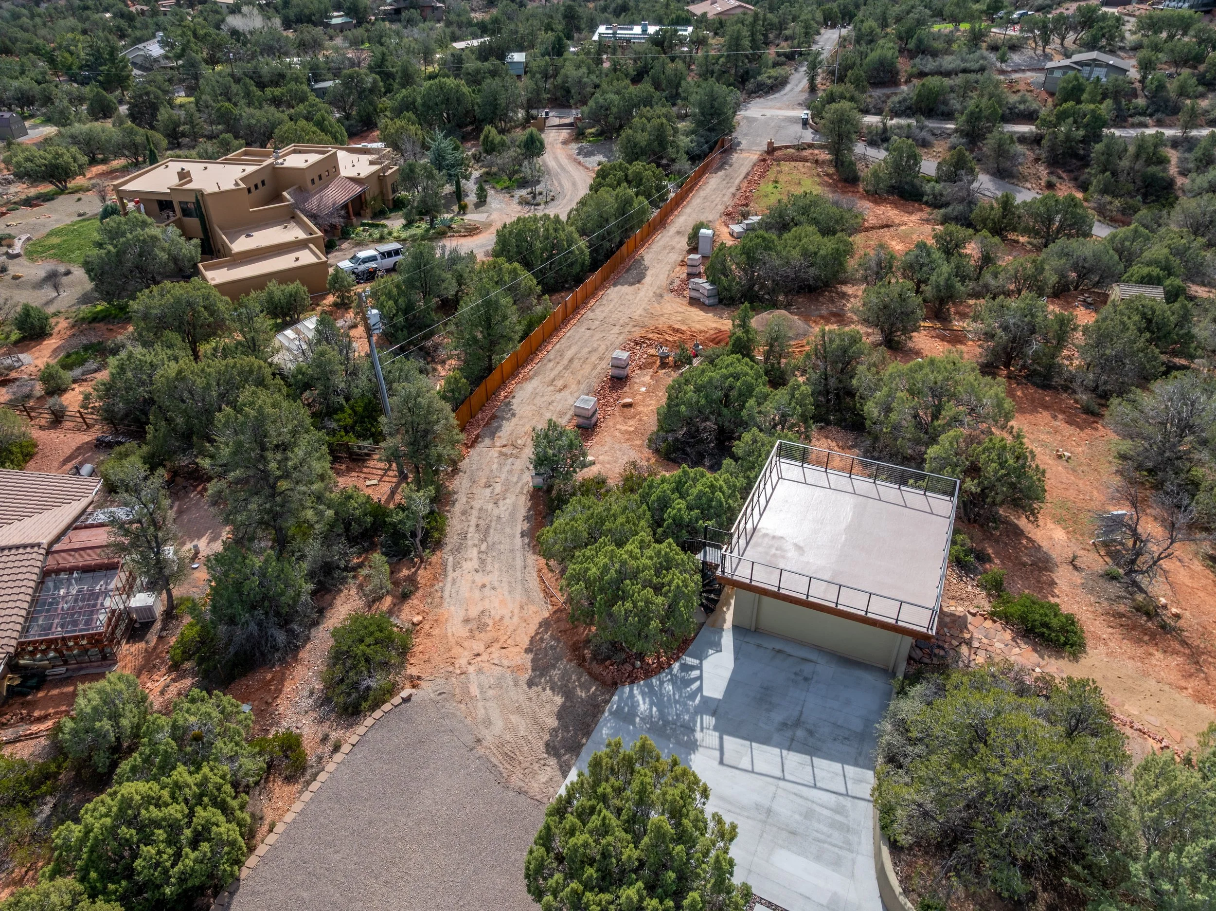
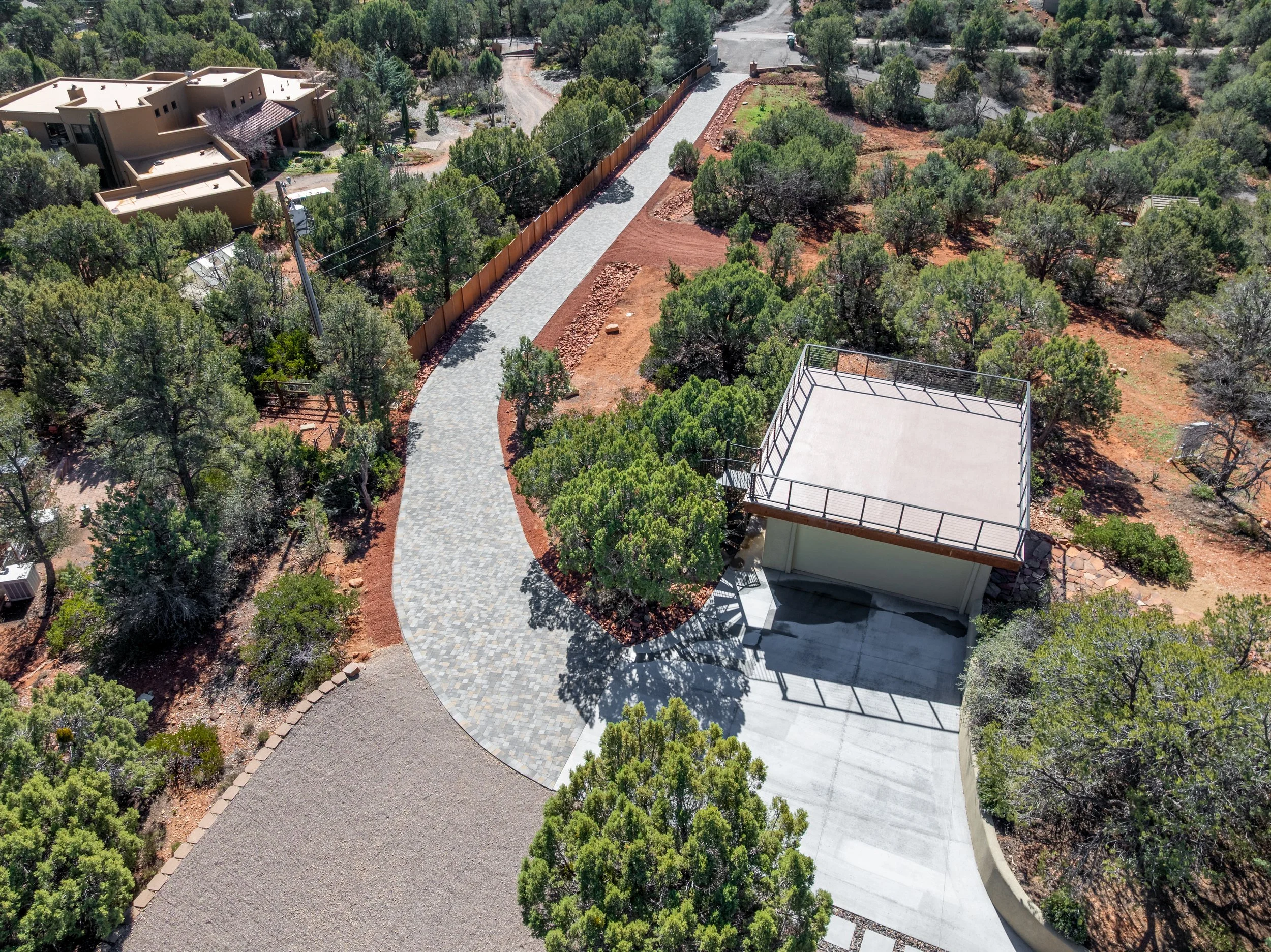
This project highlights how aerial imaging captures the full scope of a landscape transformation—from initial site conditions to final installation. Wide aerial views provide a clear understanding of property layout, terrain, and access, while mid-level angles document key elements such as driveway installation, grading, and material placement.
The progression from raw ground to finished hardscape is captured with clarity, making it easy to track changes, verify execution, and communicate results. Aerial perspectives reveal relationships between structures, landscape features, and surrounding terrain that are difficult to fully understand from ground level.
Red Rock Sky delivered these clear aerial visuals with fast, reliable turnaround, giving the client professional imagery they could use immediately.
This section presents a curated sample from the full set of aerial photography and video delivered to the client. Every project includes a complete package tailored to the client’s specific needs.
We completed a full aerial documentation shoot of the landscape transformation, capturing both still photography and smooth video footage across multiple phases. From initial site conditions through final installation, every image and clip was planned to clearly show progress, layout, and execution details for the client.
What We Delivered
Complete aerial overview of the entire site layout, terrain, and access in a single powerful image
Clear documentation of progress across multiple phases that ground-level photos cannot capture
Detailed views of grading, material placement, and installation work
Professional visuals that improve communication between the client and contractors
Fast, high-quality imagery the client could use immediately for records and presentations
How Aerial Photography Helped This Project
Ready for similar results on your next project?